UK
Storm Ciaran: Red warning in Channel Islands, 85mph gusts and ferries cancelled as wet weather sweeps towards UK


Ferry services have been cancelled and a red weather warning has been issued for the Channel Islands as Storm Ciaran sweeps in towards the south of England.
Forecasters said gusts of 85mph could hit the islands on Wednesday, with wind speeds of up to 110mph in the English Channel.
High tides could also force the closure of coastal roads and residents have been urged to “avoid outdoor activities”.
Condor Ferries has cancelled its freight and passenger routes between the Channel Islands and the UK on Wednesday and Thursday, while DFDS has axed services between Newhaven in East Sussex and Dieppe in France.
Brittany Ferries has also warned of possible disruption to its cross-Channel routes.
It comes after the Met Office issued amber weather warnings for the South West and south coast of England for Thursday as Storm Ciaran approaches.
The agency said the wind and rain warnings would be in place from Wednesday night to Friday, with the storm due to cross southern Britain on Thursday.
Ahead of its arrival, parts of Northern Ireland have already been flooded by heavy rain and people have been warned not to travel.
Check the latest five-day forecast where you are
A Met Office amber alert warning has been issued for southwest and southern England on Thursday

Met Office yellow weather warnings for rain are in place until 9am on Wednesday
Met Office yellow weather warnings for rain in the region were in place earlier today.
It warned of rainfall of between 25mm and 60mm in places, with up to 100mm on higher ground.
Yellow weather warnings for rain and wind are also in place between Wednesday and Friday across parts of England, Scotland and Wales.
Amber weather warnings are in place for Cornwall and Devon between 3am and 11am on Thursday, and between 6am and 5pm the same day along the coast from Hampshire to Kent, as well as parts of East Anglia.
Forecasters said strong gusts – of 70 to 80mph, perhaps exceeding 85 mph – could disrupt travel and cause damage to buildings, while flying debris could pose “a danger to life”.
Trains and planes could be delayed, while roads and bridges face potential closure.
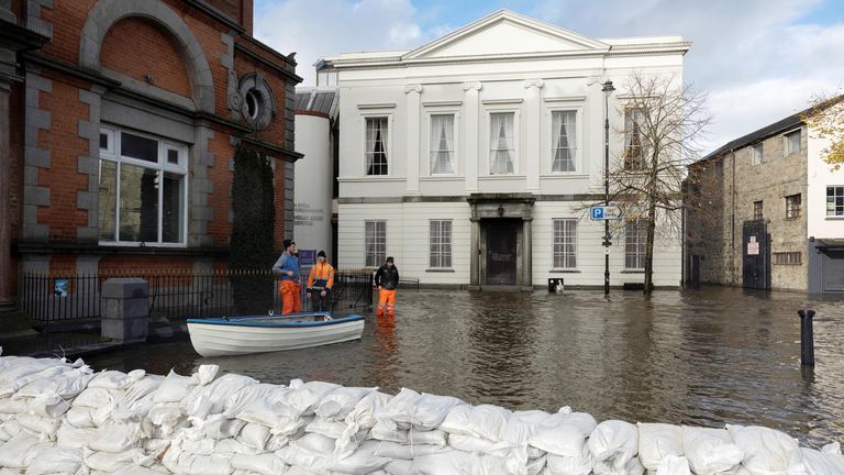
Flooding in Northern Ireland
There was flooding in Newry in County Down on Monday after the city’s canal burst its banks, while in Dromantine around 100 sheep were rescued after becoming stranded in a flooded field.
A street is sandbagged to prevent water flowing further through the streets in Newry Town, Co Down

Flood water in McCartan Bros clothes store in Newry Town, Co Down
Read more:
Why Storm Ciaran will be so bad
Newry resident Dessie Heatley described the scenes as a “repeat of what happened here around 35 years ago”.
“We were up and down here in boats,” he said. “It’s pretty bad, I’m sure all the shopkeepers are raging, we’d no warning or nothing.”
Police have advised people to avoid Newry city.

Residents row boat across flooded NI streets
Downpours expected in parts of England and Wales
Storm Ciaran is set to bring strong winds and heavy downpours to southern parts of England and Wales – with “unsettled” conditions forecast for much of the UK.
Rainfall of 20mm to 25mm is expected across southern and western areas, with potentially more falling over higher ground, the Met Office said.
Read more UK news:
Police close beach after body found on shore
Rail ticket office closures cancelled after U-turn
The forecaster warned conditions could worsen in areas already affected by flooding from Storm Babet.
Met Office meteorologist Clare Nasir said Storm Ciaran was “likely to be a notch down” in intensity from Storm Babet, but flooding could still occur because the ground is “so laden with water” and river levels “are at their highest”.
She told Sky News the key features would be “wind damage” and a “lot of rain”, and added that the wet weather would slowly move northwards.
Ms Nasir said the storm would start affecting southern areas of the UK on Wednesday evening, as well as on Thursday morning during rush hour, before it tracks northwards.
“We could see some coastal flooding because the winds will be so strong, particularly initially across more southern areas,” she said.
“It’s not a fast-moving system, so it’s going to be with us for at least two-and-a-half, if not three, days and most places will be impacted in some shape or form by this storm.”
Her colleague Marco Petagna added: “There are possible gusts of 80mph to 90mph in some exposed southern areas. It’s probably quite a nasty storm this one.”
Is Storm Ciaran affecting an area near you?
If you want to send photos or video you can send them to:
Email: news@skynews.com
If you want to send us pictures and video from your mobile phone use ‘Your Report’ on the Sky News app.
Or send us a message on WhatsApp.
By sending us your video footage/photographs/audio you agree we can broadcast, publish and edit the material and pass it onto others for similar use in any media worldwide, without any payment being due to you. Please do not submit your contribution unless you accept this.